Urban planning and architecture demand in-depth knowledge of cities and their infrastructures to effectively plan & design cities, urban planners require up-to-date mapping tools. In this article, we have covered the best urban planning software tools every urban planner must know and can use for urban mapping and city design needs.
3D Cityplanner
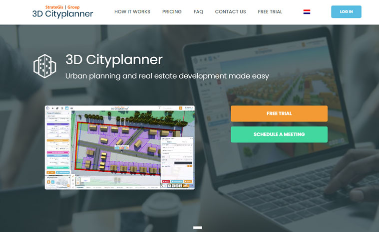
The 3D Cityplanner or 3dcityplanner.com is a 3D software tool in a browser that visualizes and calculates spatial plans intuitively. A large number of aspects like finances, land use, and sustainability can be considered and calculated. With this software, you can integrate design, calculations, and much more. As a user, you can enter all possible categories of geodata into the program, resulting in a site plan that is workable and achievable for all involved.
ArcGIS Urban
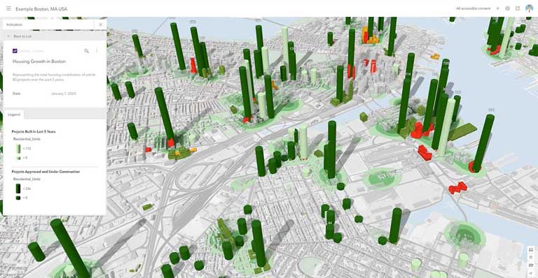
ArcGIS Urban offers urban planners a complete mapping, analytics, and collaboration solution that includes mapping tools with various features. ArcGIS Urban allows urban planners to quickly build 3D models of their cities, develop zoning plans, share data among stakeholders, and collaborate. With ArcGIS Urban, making informed decisions is very easy.
QGIS
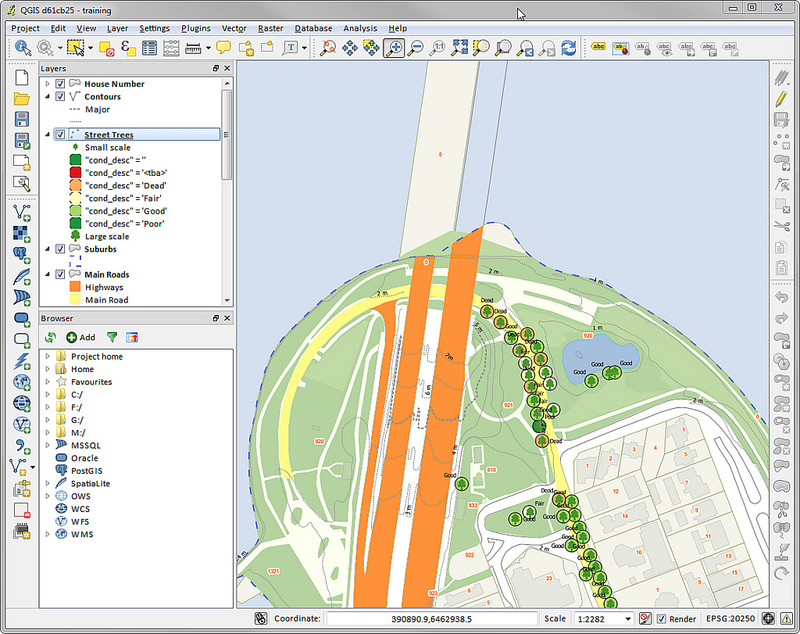
QGIS is an open-source GIS software widely used by urban planners. It allows them to analyze geospatial data, create maps and share their work with stakeholders quickly and conveniently. QGIS is highly configurable with access to an impressive selection of plugins allowing urban planners to tailor their workflow.
SketchUp
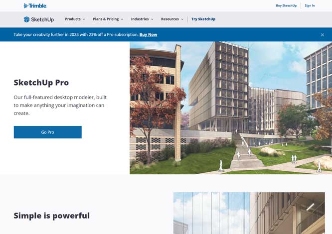
SketchUp is a 3D modeling software used widely in the architecture and urban planning industries. Urban/city planners can use SketchUp to quickly construct 3D models of their cities to show potential outcomes of decisions made during planning processes. The software user interface provides urban planners with everything they need to design urban centers successfully.
Mapbox
Mapbox is a city planning ultimate mapping platform with numerous tools at their fingertips to create custom maps, analyze data, share their work with stakeholders, and more. With Mapbox you get various useful features and customizable templates to create beautiful maps quickly and easily.
CityForm
CityForm is an easy and effective web-based tool that empowers urban planners to create 3D models for their cities and helps in analyzing purposes with visual zoning scenarios. This software is highly user-friendly and highly effective at designing cities. CityForm can give urban planners all they need to design the future city.
GeoDa
GeoDa is another urban planning software solution for geospatial data analysis and map creation. Users of GeoDa can analyze geospatial information, produce maps and share it with other users. GeoDa comes with highly customizable workflow options and plenty of add-on plugins, it enables urban planners to tailor their mapping work processes efficiently.
Esri CityEngine
Esri CityEngine, the widely used 3D modeling software used in city planning, allows urban planners to visualize how decisions impact cities by creating three-dimensional models with this mapping tool that features customizable controls that give urban planners access to an extensive suite of design tools for city design.
Google Earth Pro
Google Earth Pro, an intuitive web-based mapping tool widely utilized by urban planners, allows them to quickly create custom maps, analyze data, share their work with stakeholders, and easily collaborate on creating their cities. It also allows planners to create 3D perspective models and can also be integrated well with other top programs, such as SketchUp and GIMP. It is highly user-friendly yet provides a robust set of tools for effectively designing their cities.
SketchMap
SketchMap, an internet mapping application used extensively by urban planners, allows them to easily create custom maps, analyze data, share their work with stakeholders, and collaborate on urban design. Highly configurable yet highly accessible. SketchMap offers urban planners everything they need for city building.
Conclusion
This article’s mapping tools offer urban planners all of the resources necessary for informed decisions and creating 3D models of their cities, from ArcGIS Urban to OpenStreetMap – each provides features tailored specifically towards urban planning needs and can assist urban planners in designing environments that are sustainable, efficient and visually pleasing.
Urban planning and architecture demand deep knowledge of cities and their infrastructures, but using modern mapping tools allows urban planners to build 3D models of their cities, analyze data, share it with stakeholders, create 3D models of future infrastructure designs, and share work among stakeholders. The best urban mapping tools listed in this article give urban planners all they need for informed decisions to create sustainable cities that fulfill all citizen needs.